Out Of Phase MJO-La Nina May Suppress Nino Indices


Key Takeaways:
- La Niña continues in early February 2026 but ENSO-neutral is likely by spring.
- An evolving El Niño pattern similar to 2014 and 2018 may develop before monsoon 2026.
- Nearly 60% probability exists for below-normal monsoon rainfall under evolving El Niño.
- MJO–La Niña interaction may trigger ENSO-neutral conditions by mid-March 2026.
Pacific basin covers nearly one third of planet Earth. The ‘Ocean Heat Content’ in the tropical Pacific is the largest of all oceans and therefore, any changes, if any, get transmitted around the globe, disrupting circulation patterns. Large-scale shifts in the Pacific winds and waters initiate El Nino, but what triggers this shift remains a scientific mystery.
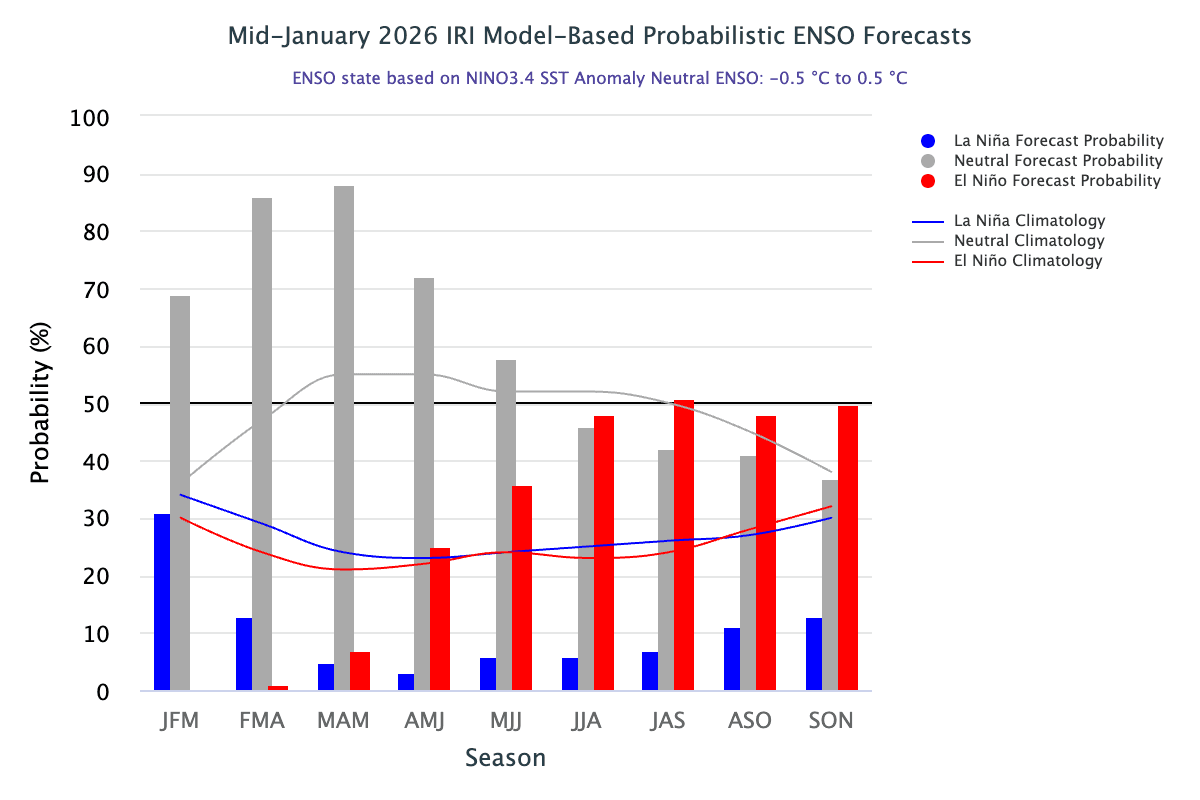
As of the start of Feb 2026, the equatorial Pacific remains in a La Nina state. There is a 75% chance of a transition to ENSO-neutral during Jan–Mar 2026. ENSO-neutral is likely at least through Northern Hemisphere late spring 2026. Beyond spring, El Nino probability becomes higher than ENSO-neutral, although they remain in the range of 48%–51%, with ENSO-neutral still the second most likely outcome. The ENSO forecast for the monsoon season 2026 is aligned with the earlier plots of 2014 and 2018. Both these years were ‘evolving’ El Nino years and the 2026 season seems to be a replica of these patterns. More than a full-blown El Nino, what is more worrisome is an evolving El Nino, which has a 60% chance of causing “below normal” monsoon rains.
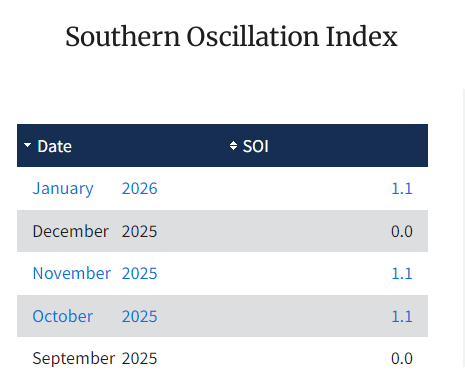
ENSO: Atmosphere and ocean both need to be in consonance for continuation of La Nina or El Nino. The Southern Oscillation Index (SOI), representing the atmosphere, has returned strongly positive yet again. In December 2025, the index had dropped to zero-zero from its successive positive values of Oct–Nov 2025. December was indicative of an early collapse of La Nina, but now the signal has reversed. Also, the Nino indices, which had dwindled earlier, have bounced back over two successive weeks. Ocean surface temperature and the low-level winds seem to be working in tandem over the equatorial tropical Pacific. This may prolong La Nina conditions well into late spring 2026.
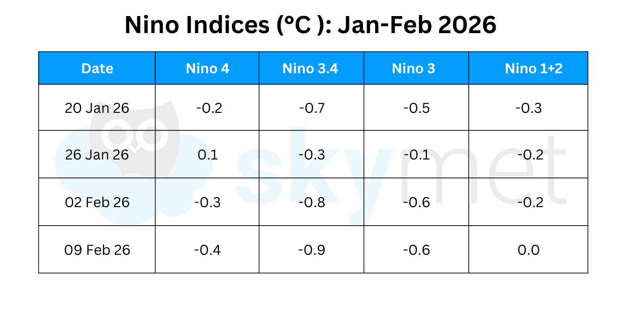
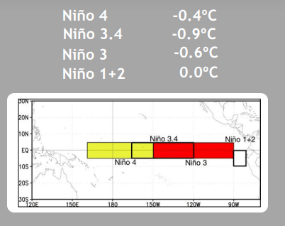
The Nino indices have been somewhat unstable over the last five weeks or so. This itself is an indication of a likely change in the status of the equatorial Pacific. The Nino 3.4 region anomaly reached the −0.9°C mark this week, which is the lowest value over the last one year. Earlier, a similar anomaly was registered on 27th Jan 2025 during the previous La Nina event. The average ONI for the last four weeks turns out to be −0.7°C, which is well beyond the threshold mark of −0.5°C. Water, as such, has a long memory and it may take some weeks for the index to drop below the threshold mark.
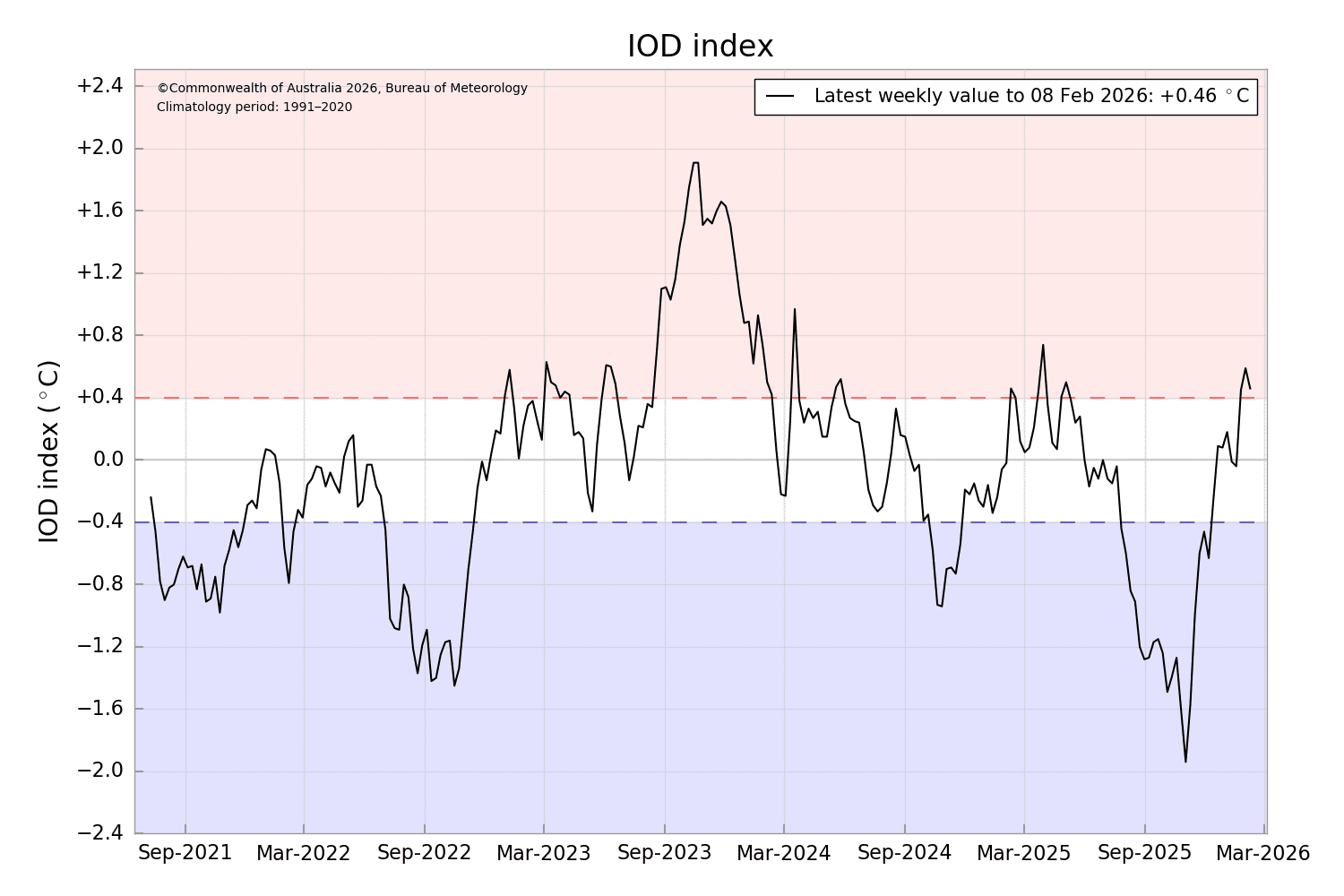
IOD: The Indian Ocean Dipole is an irregular oscillation of sea surface temperature in which the Western Indian Ocean becomes alternately warmer and then colder. The volatility invariably becomes large around spring time and tends to stabilize during early summer. The IOD index had mostly remained neutral or negative during Dec 2025 and Jan 2026. However, the index has turned positive and clocked above the threshold value of ±0.4°C. The latest value of the IOD index for the week ending 09th Feb 2026 was 0.46°C. This is the third successive week of positive IOD, albeit with a drop in magnitude from last week’s value of 0.59°C. The models continue to support neutral IOD in Mar–Apr 2026.
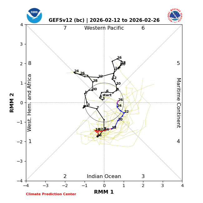
MJO: The MJO pulse, which began with small movement in mid-Jan over the Western Pacific, began propagating eastward rather quickly across the Western Hemisphere. The MJO signal is now positioned over the Indian Ocean and likely to stay in Phases 1–3 during the month of February 2026. Parallelly, La Nina conditions are continuing across the equatorial Pacific, slightly stronger than in early Feb. Historically, the composites during Jan–Mar for MJO Phases 1–3 and La Nina base state are at odds with each other for much of the tropics. The La Nina conditions are likely to weaken in the coming weeks. The MJO and La Nina interaction will favour an early changeover to ENSO-neutral.
Atmospheric anomalies over the tropical Pacific Ocean are consistent with La Nina. But there is large uncertainty in the dynamical models regarding the likely location of the MJO (from Africa to East Indian Ocean). Therefore, the MJO may interfere with La Nina to steer ENSO-neutral conditions. This ambiguous phase may last till the 4th week of Feb and clarity may come around mid-March.