ENSO Status Change From Neutral To El Nino Advisory

Key Takeaways:
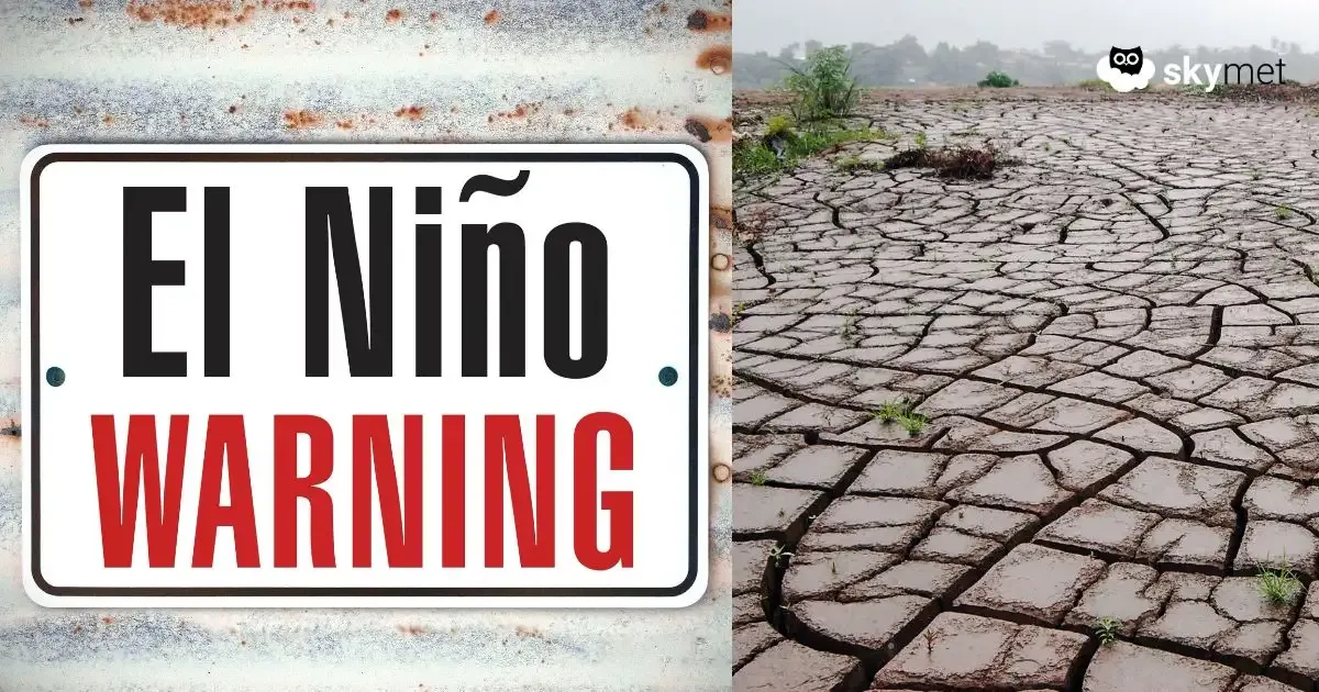
- El Niño conditions have officially developed, with all major global weather agencies now in agreement.
- Pacific Ocean warming is intensifying rapidly, with Niño 3.4 anomalies expected to reach 1.5°C by mid-July 2026.
- The Indian Ocean Dipole may turn positive later in the season but is unlikely to fully offset El Niño impacts.
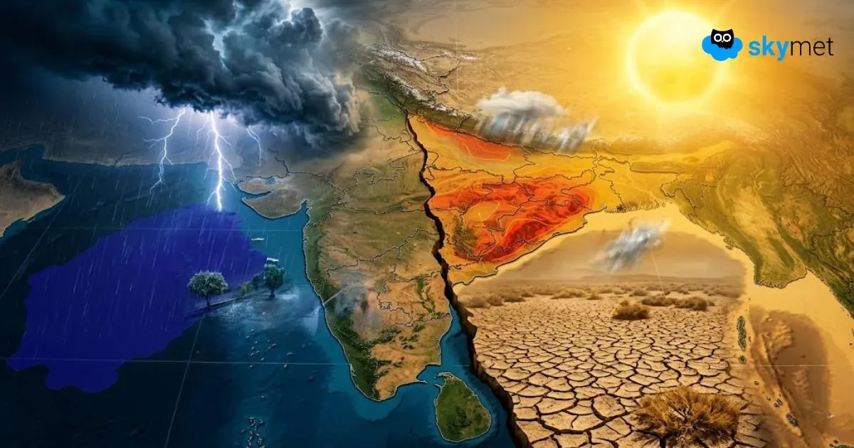
- India’s southwest monsoon is expected to remain below normal, with central and western regions facing the sharpest rainfall deficits.
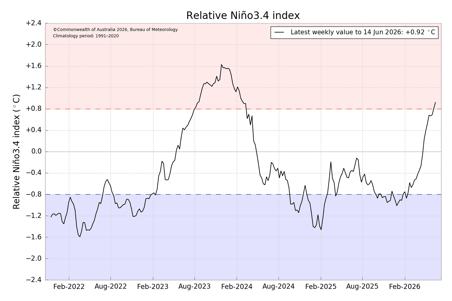
The findings and inferences of all global weather agencies are now converging, and there is broad agreement that El Niño conditions have begun over the equatorial Pacific Ocean. The Japanese weather agency, JAMSTEC, had announced the commencement of El Niño last week. As per BoM Australia, the Relative Niño 3.4 Index breached the threshold of 0.8°C for the first time since March 2024.
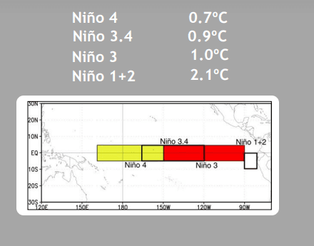
The latest weekly value for 14th June 2026 was 0.92°C. The ECMWF Niño 3.4 SST anomaly plume crossed the 1°C mark in early June. Now, the CPC-NCEP has also declared that El Niño conditions are present, and an El Niño advisory is officially in effect.
The coupled oceanic and atmospheric conditions in the tropical Pacific reflect the active development of an El Niño. Forecasters have warned about the likelihood of the event becoming very strong and ranking among the largest in historical records by late 2026.
ENSO: Warm water anomalies are spreading across the central to eastern equatorial Pacific. The Southern Oscillation Index (SOI), the atmospheric arm of ENSO, has dropped into negative territory, indicating a sustained weakening of the traditional Pacific trade winds.
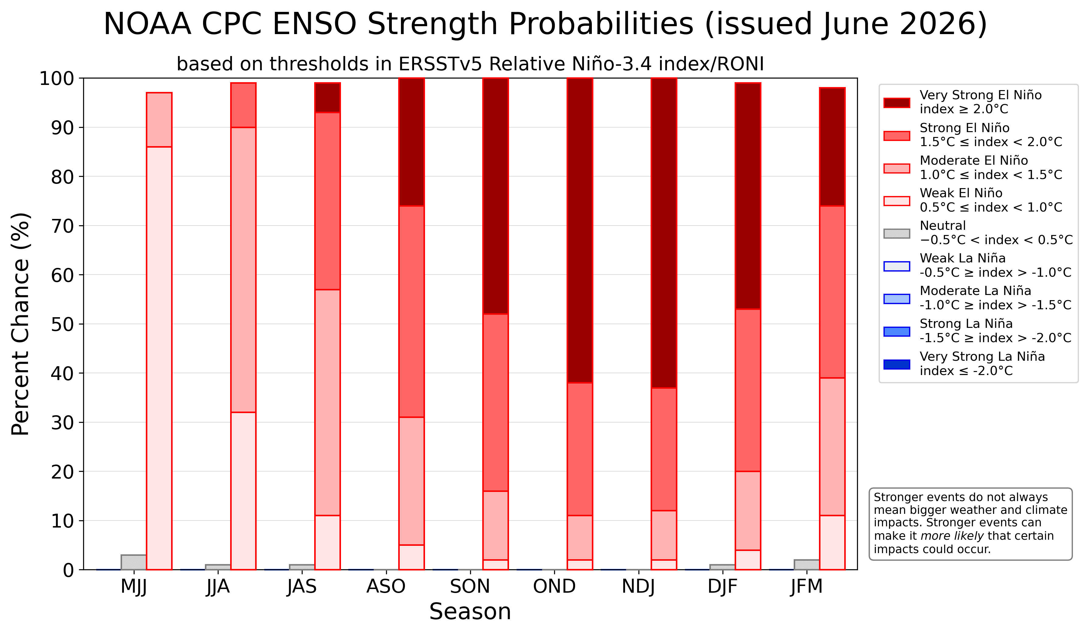
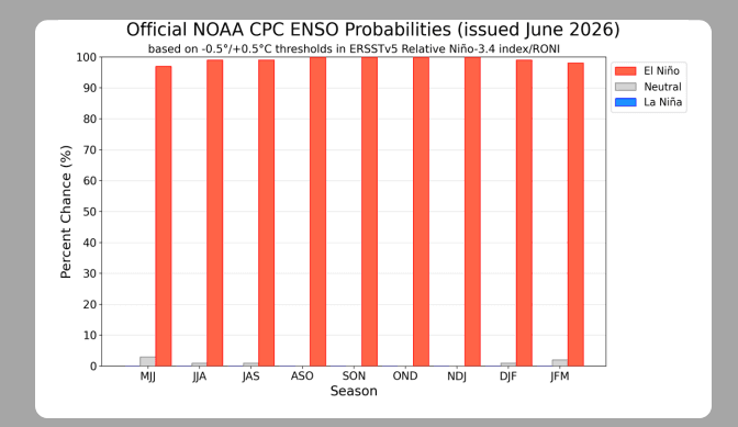
Models from the Climate Prediction Center and the IRI ENSO Forecast indicate that El Niño conditions will continue to strengthen. Probabilities for the El Niño state remain extraordinarily high, ranging between 97% and 98%, and are projected to last throughout the Northern Hemisphere winter.
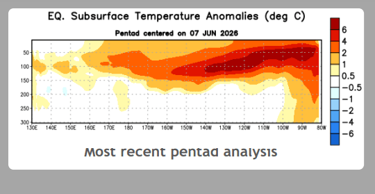
The atmospheric circulation anomalies over the equatorial Pacific Ocean are consistent with El Niño. Both atmospheric and oceanic indicators are now aligned, pointing to a rapid transition from a neutral to an El Niño state. Further, the subsurface temperature structure in the central-eastern equatorial Pacific shows a pronounced and noteworthy warming signal. In the Niño region, between 150°W and 80°W, temperatures at depths of 50–150 metres have increased substantially, with anomalies locally reaching up to 6°C.
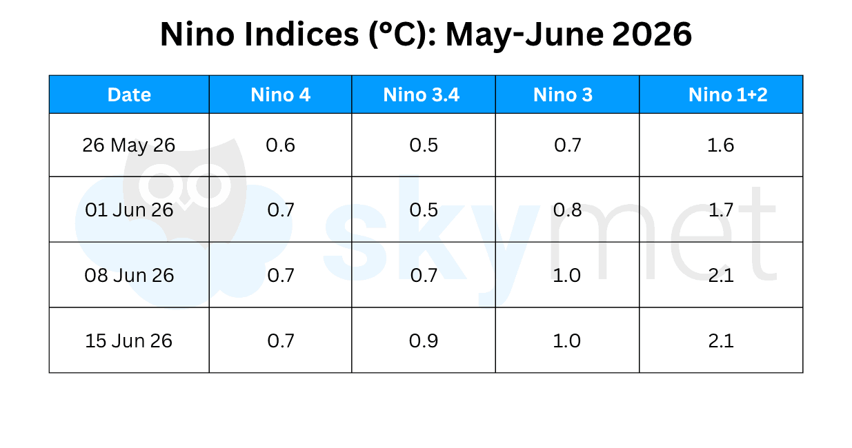
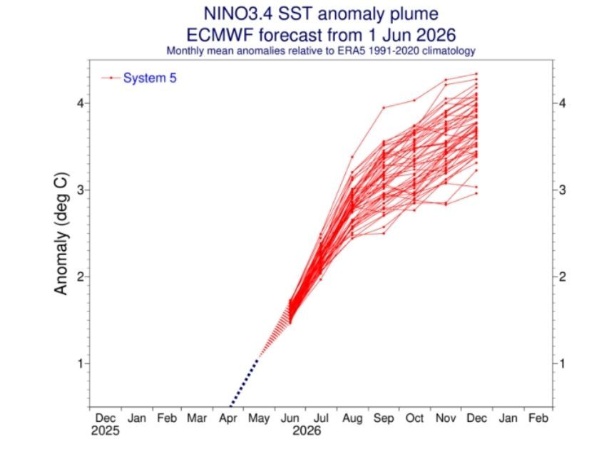
This will act as a critical energy source to further enhance the intensification of El Niño conditions. All four Niño indices have retained warming values above the threshold level of 0.5°C. The weekly temperature anomaly in the Niño 3.4 region has reached 0.9°C. It is expected to cross 1°C soon and may reach 1.5°C by mid-July 2026.
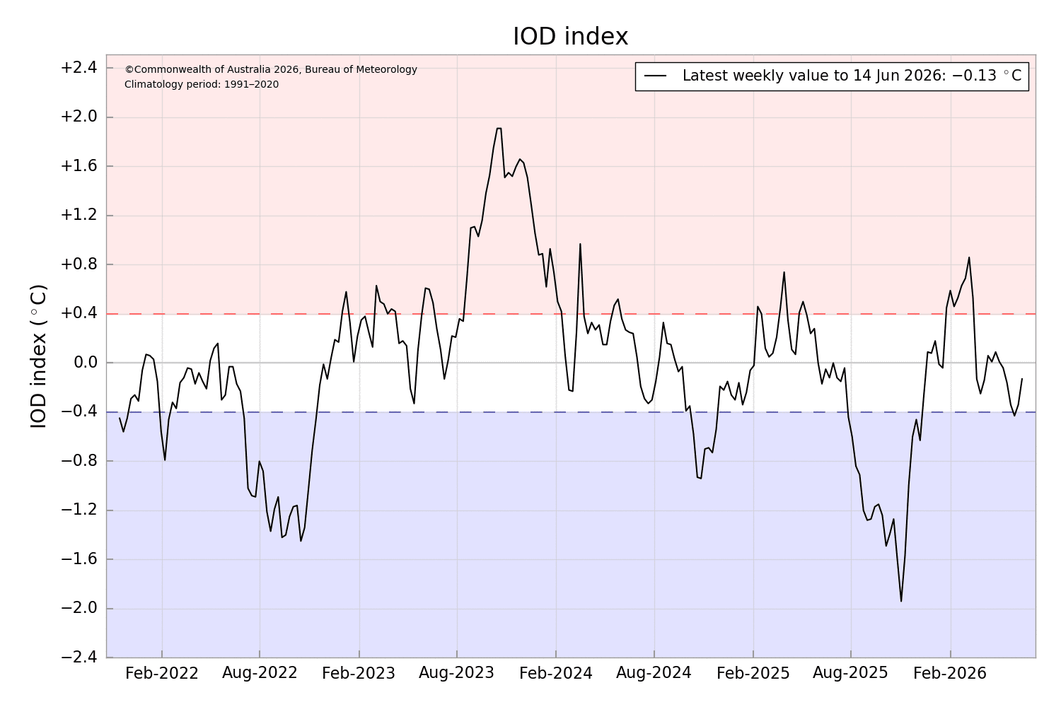
IOD: The Indian Ocean Dipole is in a negative-neutral phase and is likely to reach a neutral value shortly. The latest value of the index for the week ending 14th July 2026 was -0.13°C. Forecast models suggest that a positive phase of the IOD could emerge later in the season. However, uncertainty remains regarding whether the index will be strong enough to offset some of the adverse impacts of El Niño. As per JAMSTEC, the pioneer custodian of IOD data, the index is not likely to become very strong and, at best, may moderate the growing ill effects of El Niño during the latter part of the monsoon.
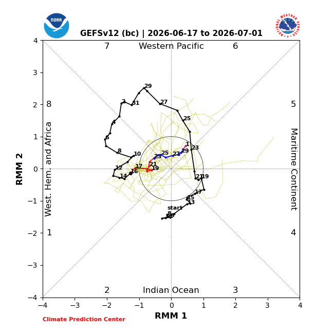
MJO: The Madden-Julian Oscillation propagates eastward in the equatorial belt around the globe. The region is divided into eight phases, and Phases 2 and 3 over the Indian Ocean are considered favourable for active spells over the Indian subcontinent.
Normally, during the core monsoon months of July and August, two to three active cycles are expected each month, and the active phase lasts for about 6–8 days. During the remaining days of June 2026, the MJO will have the least amplitude and will meander within the inner circle. The pulse is unlikely to provide any support for the Indian seas. The MJO signal is forecast to re-emerge over the Western Pacific later and amplify as well.
For India and the broader South Asian region, southwest monsoon rainfall is projected to remain significantly below normal. Despite the enhanced dry signal, regional variations will dominate. The central and western parts of the country are likely to witness the sharpest rainfall deficits.