Monsoon Faces Further Delays Over East, Central and North India

Key Takeaways:
- Southwest Monsoon remains behind schedule across East, Central, and North India.
- Monsoon activity is strengthening along the West Coast with increased rainfall over Konkan, Goa, Coastal Karnataka, and Mumbai.
- A low-pressure area over the Bay of Bengal around June 28 may trigger faster monsoon advancement across eastern and central India.
- India’s rainfall deficiency currently stands at around 42%, impacting crop sowing activities in several regions.
- Forecast Validity: June 22 to June 30.
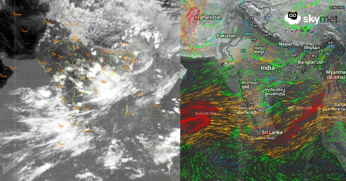
The Southwest Monsoon continues to lag behind schedule across East, Central, and North India, with both its western and eastern branches progressing slowly. As of June 22, the monsoon has advanced into more parts of Maharashtra, Telangana, southern Chhattisgarh, Odisha, Jharkhand, and Bihar.
Under normal circumstances, the monsoon would have already covered South Gujarat, large parts of Madhya Pradesh, Chhattisgarh, Jharkhand, Bihar, and even portions of eastern Uttar Pradesh, along with parts of Uttarakhand, Himachal Pradesh, and Jammu & Kashmir by this time of the season. However, the sluggish progress can largely be attributed to the lack of significant weather systems over both the Arabian Sea and the Bay of Bengal.
Meanwhile, a monsoon surge is strengthening along the West Coast, bringing moderate to heavy rainfall over Konkan, Goa, and Coastal Karnataka, including Mumbai. On the eastern side, however, the wait is expected to continue a little longer.
Weather models indicate the formation of a cyclonic circulation over the northwest Bay of Bengal around June 28. This system is likely to trigger the development of a low-pressure area, which may accelerate the monsoon advance across Bihar, Jharkhand, Chhattisgarh, Uttar Pradesh, and parts of Uttarakhand between June 28 and June 30.
Despite the anticipated improvement, the rainfall deficiency—currently around 42% as of June 21—may not recover fully during June. The first week of July appears more promising for widespread rainfall activity. However, the delayed onset has already impacted crop sowing activities across several regions. Going forward, rainfall trends during July will remain crucial, as the possibility of below-normal rainfall cannot yet be ruled out.
Read more: