Borderline La Nina Conditions: Flip To ENSO-Neutral Soon


Key Takeaways:
- El Nino Watch issued; La Nina likely to end soon with ENSO-neutral by April 2026
- Around 62% probability of El Nino developing during Jun–Aug 2026
- Peak intensity expected around November 2026, with risk of a strong or super event
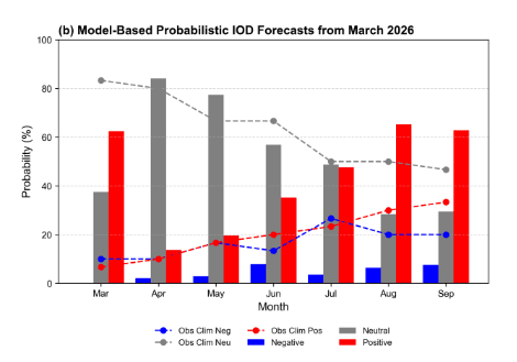
- IOD currently neutral; unlikely to strongly offset El Nino impact at this stage
America’s National Oceanic and Atmospheric Administration issued an “El Nino Watch”. It amounts to formally announcing that the continuation of La Nina since last year will cease, and transition to ENSO-neutral will commence soon. An evolving El Nino is expected to emerge during the quarter Jun-Aug 2026 with an overwhelming 62% chance.
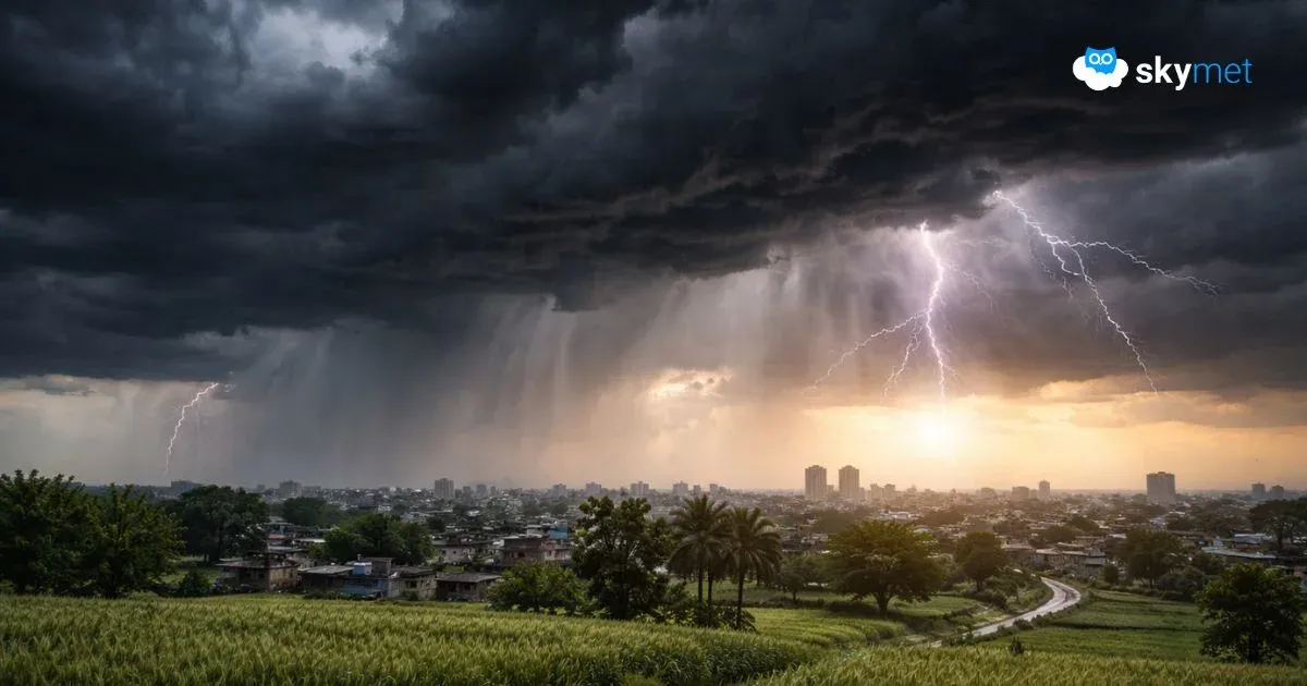
After a year and a half of La Nina conditions, the scare of El Nino is looming large, impacting during the Indian monsoon and extending till fall of the year. It is still early in terms of predictions, but a strong El Nino seems likely, experts say. The model projections are pushing for a ‘super’ El Nino, which could trigger global temperatures to record highs. The super strong El Nino event could even challenge the ferocity of the crippling episode witnessed earlier in 2015-16. At this juncture, the “spring unpredictability barrier” is still holding any broad claims of scale and strength, as the forecasts are considered less reliable around this time.
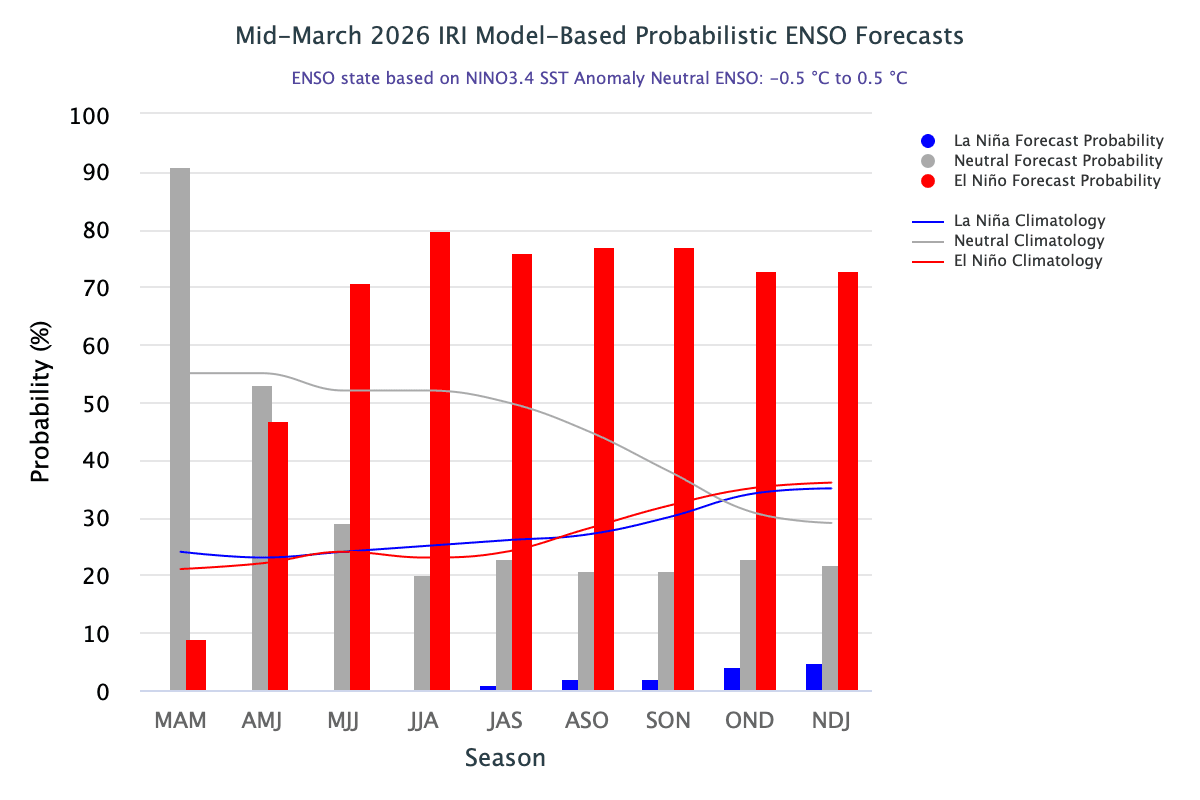
ENSO: At this moment, most of the models suggest that an El Nino will develop around June, though some models—including the Canadian one—diverge and suggest some weakening. There is nothing very unusual about such findings. Different models are run at different times, which change the base mark of initial conditions. The parameterization schemes themselves may vary from one model to another. But, there is a broad consensus among the majority of models that the peak of El Nino will occur in November 2026.
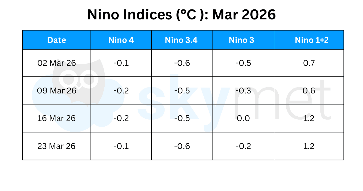
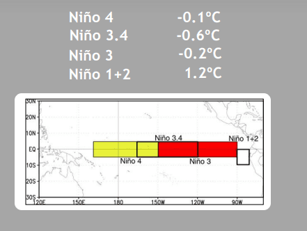
Since early Jan 2026, below-average SSTs have gradually weakened across most of the equatorial Pacific Ocean. Below-average SSTs persisted in the east-central Pacific Ocean. Beginning early Feb, above-average SSTs emerged in the far eastern equatorial Pacific, next to the coastline of Peru. A temporary cooling from the natural La Nina weather pattern continues, more visibly in the east-central Pacific Ocean. The Nino 3.4 index, the marker for monitoring, assessing, and predicting El Nino, stays close to the threshold value of -0.5°C for the last five weeks. It is expected to become neutral in April 2026.
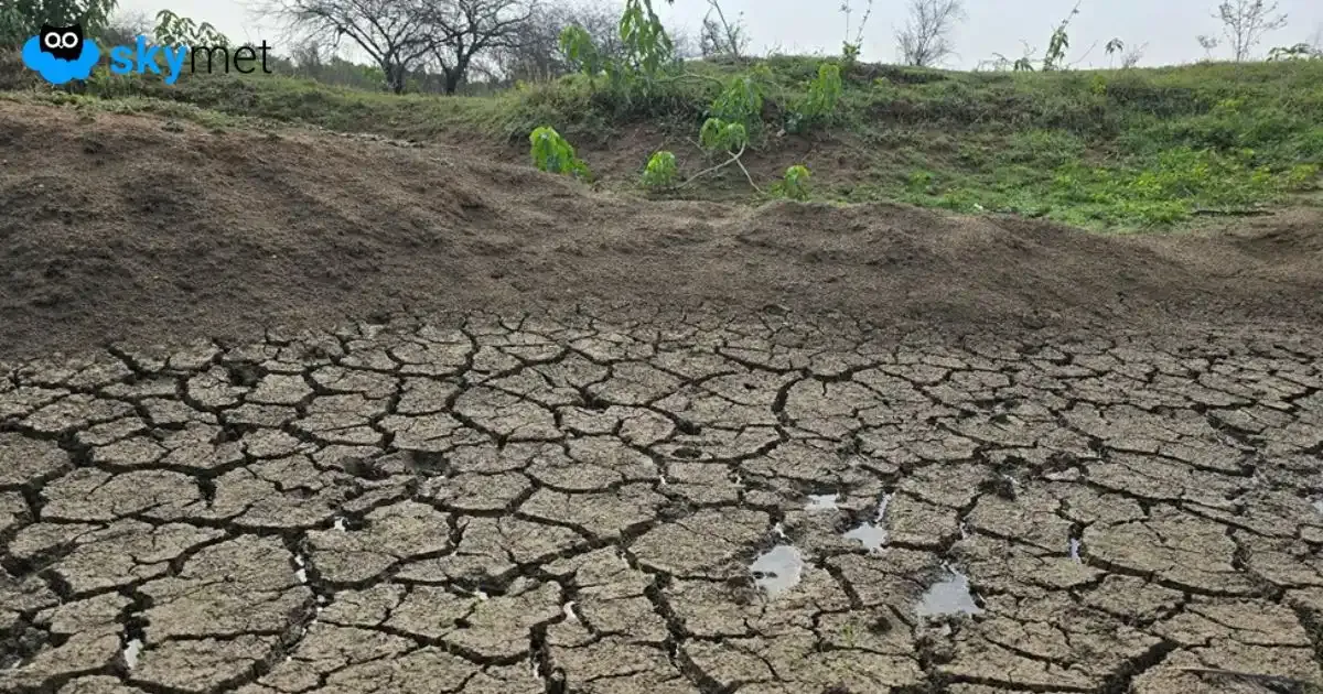
IOD: Historically, one counteracting force to El Nino has been another phenomenon called the IOD. Unlike El Nino, which acts across the world through the Pacific Ocean, the Indian Ocean Dipole acts on the regions around the Indian Ocean. A positive IOD signals a positive Indian monsoon, while a negative IOD will amplify El Nino’s drought-like conditions. Though a combination of El Nino and negative IOD is considered disastrous for the monsoon, such an event has not been witnessed for quite some time. Actually, it is the rarest of rare combinations to strike the Indian monsoon. El Nino is invariably escorted by a neutral or positive IOD. In the last three decades, there were two striking El Nino events: 1997-98, a super El Nino when the temperature anomaly reached 2.7°C, and 2015-16, another strong El Nino witnessing temperature anomaly breaching 2°C. However, during both these events, the IOD was strongly positive. Yet, the Indian monsoon collapsed in 2015 to get listed among the droughts. At the same time, the IOD was a savior in 1997 and the season ended with normal rainfall of 102% of LPA. Notwithstanding, the Indian monsoon cannot be fully dependent on the IOD to neutralize the injurious El Nino.
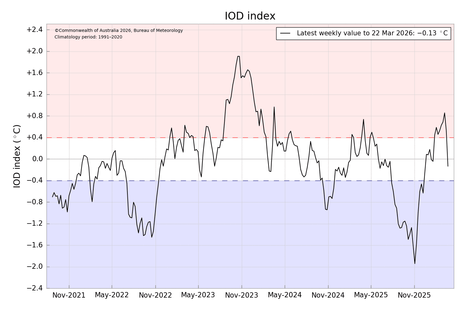
The Indian Ocean Dipole remained above the positive threshold mark of +0.4°C for eight weeks in a row, between 25 Jan–15 Mar 2026. The trend has reversed and the index has plunged to become neutral, and that too with negative denotation. The IOD value for the week ending 22 Mar 2026 was -0.13°C. The index is expected to stay within the neutral bounds of +/- 0.4°C during the month of April 2026.
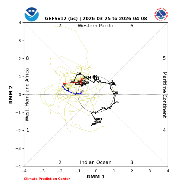
MJO: The Madden-Julian Oscillation remains active but located far away from the Indian Ocean. The pulse is propagating eastward, leaving the Western Pacific and entering the Western Hemisphere and Africa in Phase 8. During the next few weeks, the dynamical models predict constructive interaction with the large equatorial wave to produce strong low-level westerly winds across the equatorial Western Pacific. With this, the warm water may get pushed to the central Pacific and later to the east-central parts of the ocean. This will help negate the La Nina cooling and push for ENSO-neutral conditions.
The first half of April tends to be a climatologically quiet time of the year across most tropical cyclone basins. Indian seas on either side of the coastline will generally remain silent. However, deep inland, the pre-monsoon activity is likely to become strong and spread out, covering large parts of the country during the next two weeks.