Low Pressure Over Bay To Become Well Marked: Unlikely To Strengthen Further; Before Time Monsoon Over Andaman Sea

Key Takeaways:
- The low-pressure area off Sri Lanka has shifted to the Southwest Bay of Bengal near the Tamil Nadu coast.
- The system may intensify slightly into a depression, but cyclogenesis chances remain low.
- Tamil Nadu and adjoining regions are likely to witness increased rain and thunderstorm activity.
- Monsoon onset over the South Andaman Sea and Bay Islands is likely around May 16, 2026.
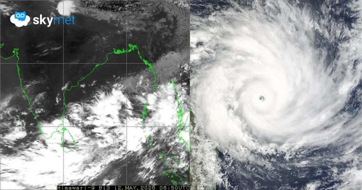
The low-pressure area over the Bay of Bengal, off the Sri Lanka coast, has moved northward and is now lying over the Southwest Bay of Bengal, off the Tamil Nadu coast. It is associated with a cyclonic circulation extending up to the mid-levels of the atmosphere. The system is likely to become more marked during the next 24–48 hours. It is expected to remain over the sea and is unlikely to cause any adverse weather activity over the Southern Peninsula.
Most weather models indicate minimal intensification of the system. Environmental conditions are only marginally favourable for further strengthening. At best, the system may intensify into a depression before drifting away from the coastline while weakening gradually. The probability of cyclogenesis remains quite low.
Rain and thundershowers are very likely over south coastal Tamil Nadu and adjoining interior parts of the state. The system has already lashed Sri Lanka with very heavy rainfall during the last 24 hours. Isolated heavy showers were also recorded along the south coast of Tamil Nadu. As the system moves northward, weather activity is expected to increase further over Tamil Nadu.
The weather system is likely to move toward the central parts of the Bay of Bengal. Cross-equatorial flow is expected to strengthen significantly. Strong southwesterly winds will sweep across the north-south oriented chain of Bay Islands, from Nan Cowry to Maya Bandar, including Car Nicobar and Port Blair. There is a strong possibility of monsoon onset over the Southeast Bay of Bengal, South Andaman Sea and Bay Islands around May 16, 2026, with an error margin of ±1 day.
However, mainland India may have to wait slightly longer for monsoon advancement. The required atmospheric conditions are unlikely to align over the Arabian Sea and Kerala coast for at least another week or even longer.