Skymet Weather Forecast April 11: Heavy Rain in Assam, Meghalaya Mercury Rising in NorthWest, Central and East


Representational Image: AI-Skymet
Key Takeaways:
- Multiple cyclonic circulations influencing weather across India
- Rain activity concentrated over Northeast and southern regions
- Western Disturbance weakening but another system approaching April 15
- Temperatures rising across Northwest, Central, and East India
Weather Systems Over the Country
The Western Disturbance, seen as a cyclonic circulation over Jammu, has become less marked and moved eastward.
A cyclonic circulation is over Bangladesh at 0.9 km above mean sea level.
Another cyclonic circulation is over Northeast Assam at 1.5 km above mean sea level.
A trough extends from Odisha to the Gulf of Mannar across Telangana, Rayalaseema, and Interior Tamil Nadu at 0.9 km above mean sea level.
A cyclonic circulation is over Southwest Rajasthan and adjoining South Pakistan.
Another cyclonic circulation is over North Tamil Nadu at 1.5 km above mean sea level.
A Western Disturbance is expected to approach the Western Himalayas on April 15.
Weather Activity During the Last 24 Hours
During the last 24 hours, light to moderate rain occurred over Northeast India, Coastal Odisha, Gangetic West Bengal, Tamil Nadu, and the Western Himalayas.
Isolated light rain occurred over the Andaman and Nicobar Islands.
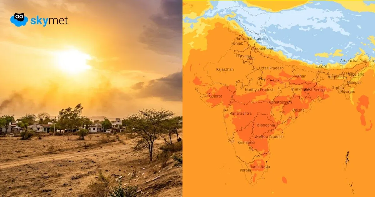
Maximum temperatures increased by 2°C to 3°C over Punjab, Haryana, Delhi, Uttar Pradesh, Bihar, Jharkhand, West Bengal, North Odisha, Chhattisgarh, parts of Madhya Pradesh, and Gujarat.
Forecast
During the next 24 hours, light to moderate rain and thunderstorms may occur over Sikkim, Arunachal Pradesh, Meghalaya, Nagaland, and Assam.
Isolated light rain is possible over Manipur, Mizoram, Tripura, Kerala, and Tamil Nadu.
Maximum temperatures are likely to increase further over Northwest, Central, and East India during the next 3 to 4 days.
Skymet Exclusives: