Record-Breaking Rain Lashes Chittorgarh in Rajasthan

Representational Image: AI-Skymet
Key Takeaways:
- Chittorgarh recorded an exceptional 245 mm rainfall in just 24 hours on June 24.
- The rainfall exceeded two and a half times the city’s normal June monthly average.
- Moisture influx from the Arabian Sea and a cyclonic circulation triggered the extreme weather event.
- Light to moderate rain and thunderstorms may continue over southeast Rajasthan during the next 48 hours.
- Forecast validity: next 2 days
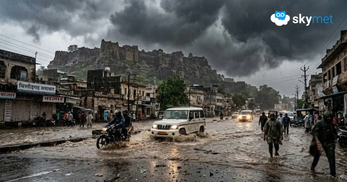
The historic city of Chittorgarh in southeast Rajasthan witnessed an extraordinary spell of rainfall on June 24, recording a staggering 245 mm of rain within 24 hours. The rainfall was more than two and a half times the city’s normal June monthly average of 95.8 mm, making it one of the heaviest single-day rainfall events in recent decades.
Such an intense downpour is extremely rare for Chittorgarh, particularly during June when Southwest Monsoon activity is generally just beginning to strengthen over the region.
Why Did Chittorgarh Receive Such Heavy Rain?
Several meteorological factors combined to produce this exceptional rainfall event.
A strong flow of moisture-laden southwesterly winds from the Arabian Sea persisted over Rajasthan at the lower atmospheric levels. At the same time, a cyclonic circulation extending between 3.1 km and 5.8 km above mean sea level remained positioned over southeast Rajasthan.
The interaction between abundant moisture, atmospheric instability, and intense daytime heating created ideal conditions for the rapid development of towering cumulonimbus clouds. These thunderclouds continued to regenerate over the same region, resulting in prolonged spells of very heavy to extremely heavy rainfall.
Flash Floods Disrupt Normal Life
The torrential rain inundated roads and streets across Chittorgarh, leading to widespread waterlogging and flash floods in several low-lying areas. Traffic movement was severely affected, while normal day-to-day activities came to a standstill as many parts of the city remained submerged under water.
The event serves as a reminder that even regions not typically associated with extreme rainfall can experience cloudburst-like conditions when atmospheric parameters align favorably.
Rainfall Activity to Continue
The cyclonic circulation responsible for the heavy rainfall continues to persist over southeast Rajasthan. Therefore, thunderstorms accompanied by light to moderate rain are likely to continue for the next 48 hours across Chittorgarh and adjoining districts.
However, the intensity of rainfall is expected to reduce significantly compared to the deluge witnessed on June 24. Most of the rain activity will be localized and is likely to occur during the late afternoon and evening hours, typical of convection-driven thunderstorms.
While no repeat of such record-breaking rainfall is anticipated, residents should remain alert for brief heavy showers and localized waterlogging during the next couple of days.
Trending: